Origins of Civilisation · Khadir Bet, Kutch, Gujarat, India

Dholavira

A desert island city that harvested monsoon rains through cascading stone reservoirs — and hung out the world's oldest signboard.

Mainstream: c. 3000–1500 BC (Harappan)Alternative: Claimed as a city of the Vedic Saraswati tradition, with regional roots pushed back to c. 7000 BC23.89°, 70.21°

At a glance

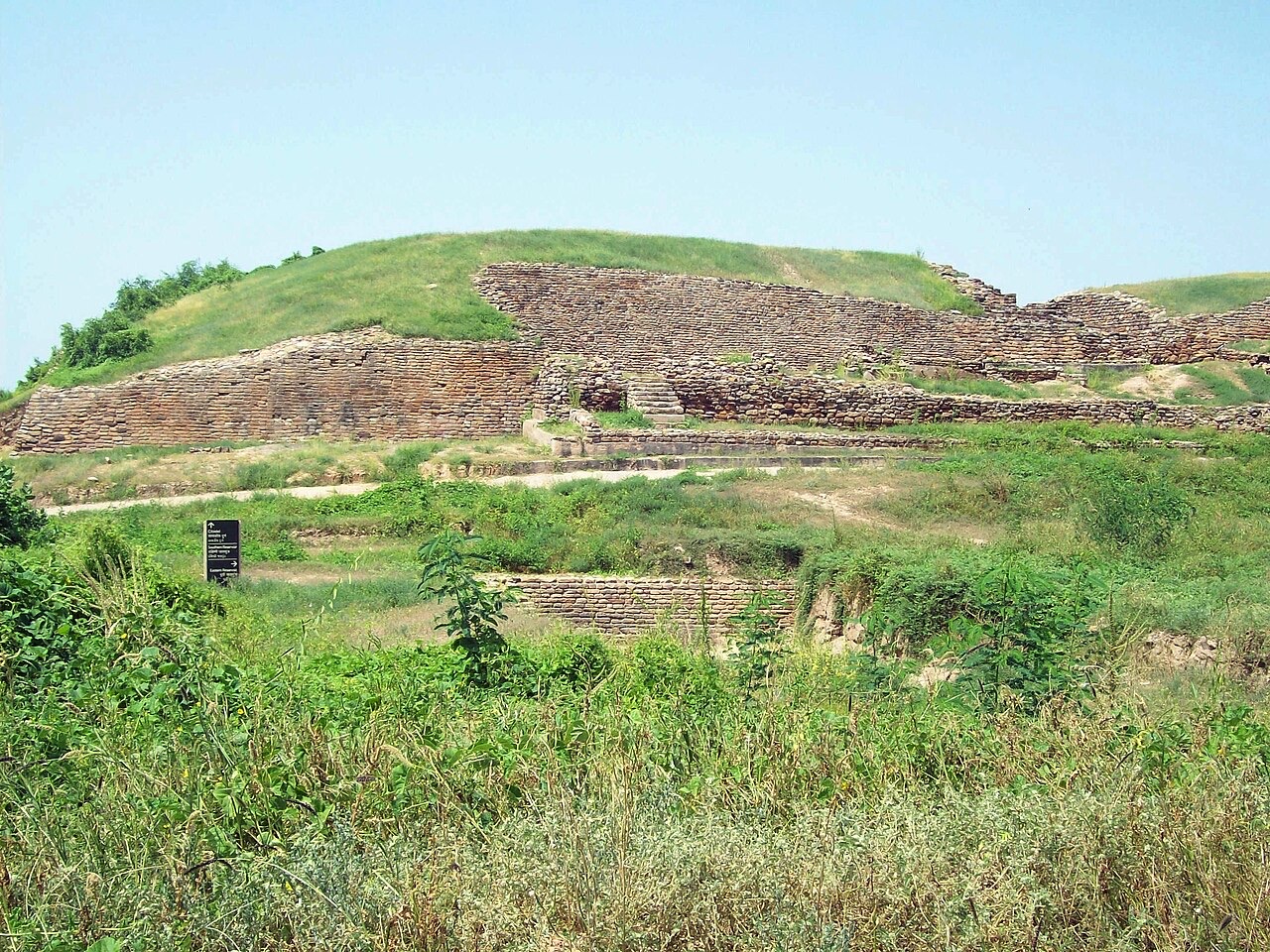
Dholavira
Photo: Himalyan · CC BY-SA 3.0

Dholavira occupies the arid island of Khadir Bet in the Great Rann of Kutch, a salt desert that 4,500 years ago bordered navigable water. Excavated between 1990 and 2005 under R. S. Bisht of the Archaeological Survey of India, this fifth-largest Harappan city flourished from about 3000 to 1500 BC. Its genius was water: at least sixteen rock-cut and masonry reservoirs, check dams on two seasonal streams and cascading channels let a city of stone survive in one of India's driest landscapes. Above its northern gate archaeologists found the 'signboard' — ten large Indus signs set in gypsum, perhaps the world's oldest public inscription, in a script that remains undeciphered. UNESCO listed Dholavira in 2021.

See it on the globe →
The mainstream view

What archaeology says

To mainstream archaeology Dholavira is the masterclass in Harappan hydraulic and civic engineering. Uniquely among major Indus cities it was built largely of stone rather than brick, laid out in a nested plan — citadel ('castle' and 'bailey'), middle town and lower town — inside massive walls, with a ceremonial ground and a sequence of enormous reservoirs, some cut five metres or more into bedrock, storing perhaps 250,000 cubic metres of monsoon runoff. Bisht's excavations traced seven occupation stages from an early settlement around 3000 BC through the mature urban climax (c. 2600-1900 BC) into de-urbanised late phases ending by about 1500 BC.

The signboard is emblematic of the Indus enigma: ten signs, each about 37 centimetres tall, apparently mounted above the north gate for all to see — implying an audience that could read them — in a script of roughly 400-700 signs that has defeated every decipherment attempt, largely because inscriptions average just five signs and no bilingual text exists.

Dholavira's decline tracks the wider Harappan story: reservoir maintenance falters, the city contracts, and occupation ends amid the aridification that peaked around the 4.2-kiloyear climate event, compounded locally by the drying of rivers feeding the Rann and the retreat of the sea that had connected the city to Gulf trade — Dholavira imported and worked copper and shipped beads and shell as part of the Meluhha trade with Mesopotamia.

Key evidence cited
  • Seven stratified occupation stages, c. 3000-1500 BC, documented in R. S. Bisht's ASI excavations
  • At least sixteen reservoirs and check dams forming the most elaborate water system of any Bronze Age city
  • The ten-sign gypsum signboard, unique in the Indus world as a probable public inscription
  • Stone architecture, nested town plan and a stadium-like ceremonial ground showing centralised planning
  • Bead, shell and copper workshops tying Dholavira into documented Indus-Mesopotamia trade
  • Decline phases correlating with the 4.2-kiloyear aridification event and retreat of navigable water from the Rann
The alternative view

What the skeptics propose

Dholavira sits inside India's liveliest historical argument: the relationship between the Indus civilisation and Vedic culture. Writers such as Michel Danino, author of The Lost River, argue that the Ghaggar-Hakra river system east of the Indus is the Saraswati of the Rig Veda, that Harappan sites clustered along it constitute a 'Sindhu-Saraswati civilisation', and that Harappan and Vedic cultures are substantially the same people — making Dholavira's builders, in effect, early Vedic Indians. This view, supported by some Indian archaeologists including, in later statements, figures associated with the ASI, is rejected by most Western and many Indian scholars, who date the Rig Veda after 1500 BC and note the absence of horses and chariots in Harappan art. The naming battle — Indus versus Saraswati — is fought in Indian textbooks and newspapers, not just journals.

Chronology is a second front. High-profile studies of nearby sites — notably the 2016 claim by Anindya Sarkar's team that Bhirrana in Haryana shows continuous occupation back to c. 7500 BC — have been used to argue the civilisation's roots are millennia older than the standard model, and by extension that its cities inherit an immensely old indigenous tradition. Mainstream reviewers accept early village layers but reject stretching the urban Harappan backwards.

Catastrophists have their entry too: a 2020 study by C. P. Rajendran and colleagues argued Dholavira's massive walls show damage consistent with ancient tsunamis striking the Rann, and researchers agree the sea once reached Khadir Bet — a reminder that this desert city was born maritime and died landlocked, a transformation dramatic enough to feed any legend.

Key evidence cited
  • Michel Danino's identification of the dried Ghaggar-Hakra with the Vedic Saraswati, recasting Harappans as Vedic people
  • Claims of settlement continuity in the region back to c. 7500 BC based on Bhirrana dates
  • The undeciphered script, which leaves the city's language and identity open to every hypothesis
  • Reported tsunami damage to Dholavira's walls suggesting remembered catastrophe in the Rann
  • Hydraulic sophistication argued by some to presuppose a long, older engineering tradition
  • The sea's retreat from Khadir Bet within human memory of the city, a real-world drowned-world inversion

Genuinely open questions

  1. What did the signboard say, and could the Indus script ever be deciphered without a bilingual text?
  2. Is there any demonstrable continuity between Harappan Dholavira and later Indian tradition?
  3. How much did tsunamis, sea retreat and river death each contribute to the city's end?
  4. Why did Dholavira alone among great Harappan cities build in stone?

Worth knowing

Dholavira's reservoirs were so well engineered that the modern village on Khadir Bet still suffers water scarcity the Bronze Age city had solved — its largest rock-cut tank is bigger than an Olympic swimming pool, carved with bronze tools.