Lost Worlds · Off Yonaguni Island, Okinawa Prefecture, Japan

Yonaguni Monument

A colossal stepped terrace beneath the East China Sea — nature's masterpiece of jointed sandstone, or the drowned monument of an Ice Age culture?

Mainstream: Natural sandstone formation (Miocene bedrock c. 20 million years old, shaped by erosion — no human construction date)Alternative: c. 10,000–8,000 BC if carved before post-glacial sea-level rise (Kimura later argued for shaping 2,000–3,000 years ago followed by tectonic submergence)24.44°, 123.01°

At a glance

Yonaguni Monument
Photo: Melkov · CC0 (public domain)

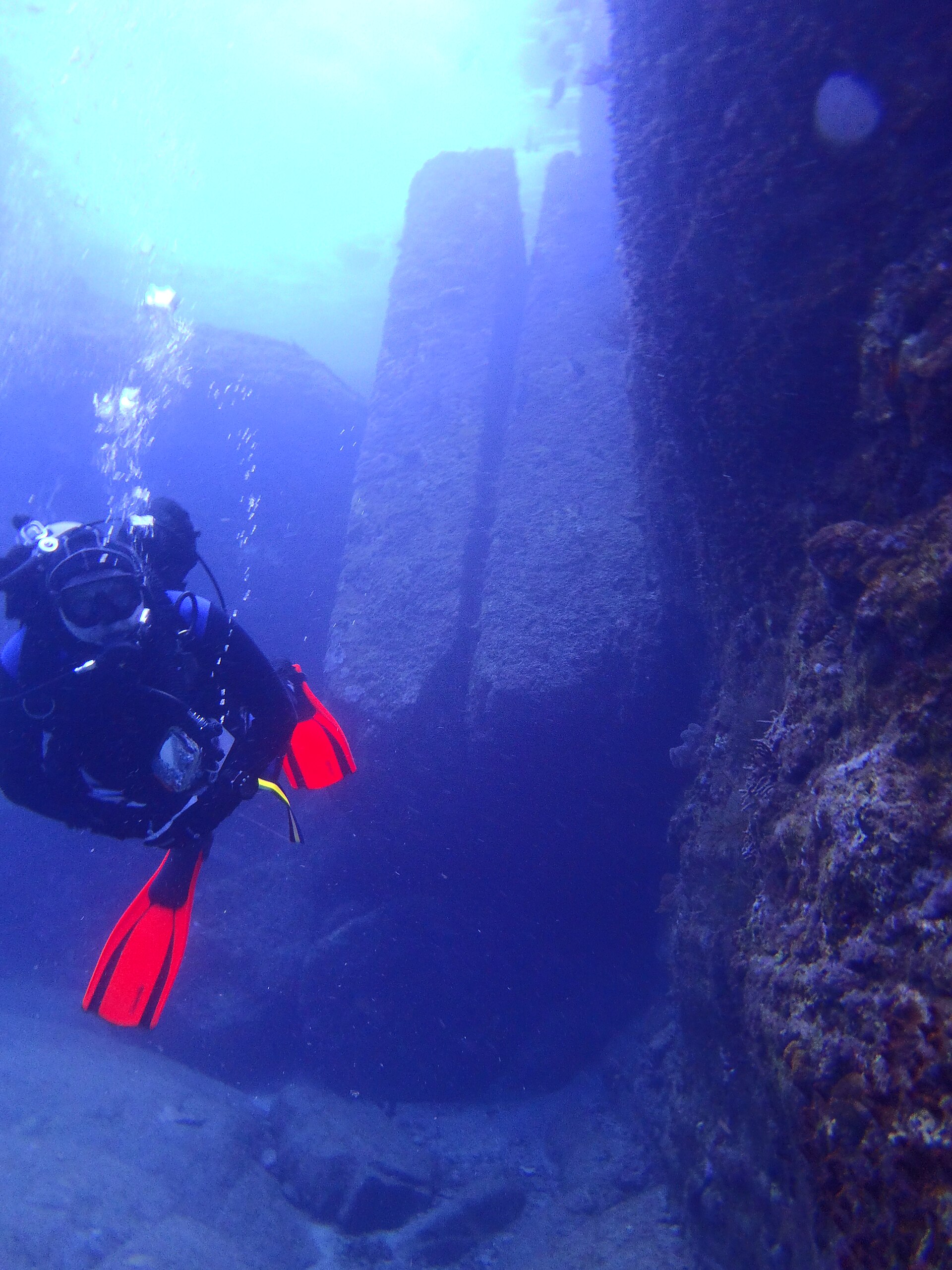
In 1986 local dive operator Kihachiro Aratake, scouting new spots to watch hammerhead sharks off the southern coast of Yonaguni — Japan's westernmost island — came upon a massive rock formation resembling a stepped monument. The main structure is roughly 50 metres long and 20 metres wide, rising about 25 metres from the seabed with its upper surfaces only around 5 metres below the waves. Divers describe flat terraces, near-vertical faces, a feature dubbed the 'Main Terrace', twin megalith-like blocks and channels that resemble walkways. Cut from fine sandstones and mudstones of the Lower Miocene Yaeyama Group, the 'monument' has become one of the world's most photographed underwater enigmas — and the centrepiece of a three-decade argument between geologists.

See it on the globe →
The mainstream view

What archaeology says

Most geologists who have examined the site conclude it is a natural formation. Boston University geologist Robert Schoch — famously open to an older Sphinx — dived Yonaguni in 1997 and 1998 and found that the sandstones contain well-defined, parallel bedding planes along which layers separate cleanly, criss-crossed by sets of vertical joints. In a wave- and typhoon-battered coastal zone, such rock naturally fractures into steps, terraces and right angles; near-identical formations can be seen above water on Yonaguni's own coastline, such as at Sanninudai. German geologist Wolf Wichmann, who dived the site with Graham Hancock in 1999 and again in 2001, likewise concluded that nothing there requires human hands.

The strongest mainstream point is negative evidence: in nearly four decades of intensive diving, no securely documented artefact — no pottery, no tool, no post-hole, no inscription accepted by independent specialists — has been recovered from the structure itself. Japan's Agency for Cultural Affairs and the Okinawa Prefectural government do not recognise the monument as a cultural property, and no state-funded archaeological excavation has been mounted. Sceptics also note that the 'steps' are generally too large and irregular for human use, and that strong currents at the site are fully capable of sweeping surfaces clean and sculpting hollows that pattern-seeking eyes read as carvings.

Mainstream researchers do not dispute that the platform was dry land during the last glacial maximum, when sea levels were some 120 metres lower and Yonaguni may have been connected toward Taiwan — they simply argue that being accessible to Ice Age people is not evidence that those people carved it.

Key evidence cited
  • Parallel bedding planes and orthogonal joint sets in Yaeyama Group sandstone naturally produce steps and right angles
  • Nearly identical terraced formations exist above water on Yonaguni's coast, such as at Sanninudai
  • No artefact, tool mark or inscription accepted by independent specialists has been recovered in almost 40 years of diving
  • Independent geologists Robert Schoch (1997–98) and Wolf Wichmann (1999, 2001) both concluded the structure is natural
  • Japanese cultural authorities do not recognise the site as an archaeological or cultural property
The alternative view

What the skeptics propose

The case for artificiality rests overwhelmingly on one credentialed champion: Masaaki Kimura, emeritus professor of marine geology at the University of the Ryukyus, who has studied the formation since the early 1990s. Kimura argues the monument is a terraced, quarried complex, cataloguing what he identifies as tool marks, drainage channels, a 'loop road' encircling the structure, post-holes, a carved turtle-like relief, rudimentary characters and animal effigies — some fragments of which he says he has recovered and examined in his laboratory. He initially proposed the complex was shaped more than 10,000 years ago before the post-glacial seas rose; he later refined his view, suggesting it may have been worked 2,000–3,000 years ago when tectonic movement held the land higher, then dropped beneath the sea by seismic activity — this is, after all, one of the most earthquake-prone coasts on Earth.

Graham Hancock devoted a substantial section of his 2002 book 'Underworld' to Yonaguni, diving the site repeatedly and highlighting features he found hard to attribute to chance — notably the 'twin megaliths', two huge parallel blocks standing upright side by side in a niche with a gap of barely 10 centimetres between them, and the sharply cut north-west 'arch'. For Hancock, Yonaguni is a flagship example of his wider thesis that the drowned continental shelves of the Ice Age world hide the earliest chapters of civilisation. Even Schoch has conceded the possibility of a 'terra-formed' middle ground — a natural formation partially modified or used by ancient people — though he considers the core structure natural.

The debate periodically reignites: viral coverage in 2024–2025, including discussion on high-profile podcasts, recast Yonaguni as a 'Japanese Atlantis', prompting geologists to restate the natural-formation case. Proponents respond that no systematic, funded excavation has ever tested Kimura's claims — so the question, they argue, remains formally open.

Key evidence cited
  • Kimura's catalogue of claimed quarry marks, post-holes, drainage channels and a 'loop road' surrounding the structure
  • The twin megaliths — two massive upright parallel blocks separated by a gap of under 10 centimetres
  • Claimed carvings, rudimentary characters and animal-shaped rocks, some fragments examined in Kimura's laboratory
  • The platform was dry, habitable land during the last glacial maximum, when sea level was about 120 metres lower
  • The region's extreme seismicity offers a mechanism for sudden submergence independent of slow sea-level rise

Genuinely open questions

  1. Why has no systematic, state-sanctioned archaeological excavation ever been conducted at the site?
  2. Could the structure be a 'terra-formed' hybrid — a natural terrace partially modified or ritually used by ancient islanders?
  3. Are Kimura's claimed characters and effigies genuine artefacts, natural scratches, or marine bio-erosion?

Worth knowing

Kihachiro Aratake wasn't looking for a lost civilisation when he found the monument in 1986 — he was scouting a new spot to watch hammerhead sharks. The site he discovered is now a dive attraction named 'Iseki Point', Japanese for 'Ruins Point'.