What archaeology says
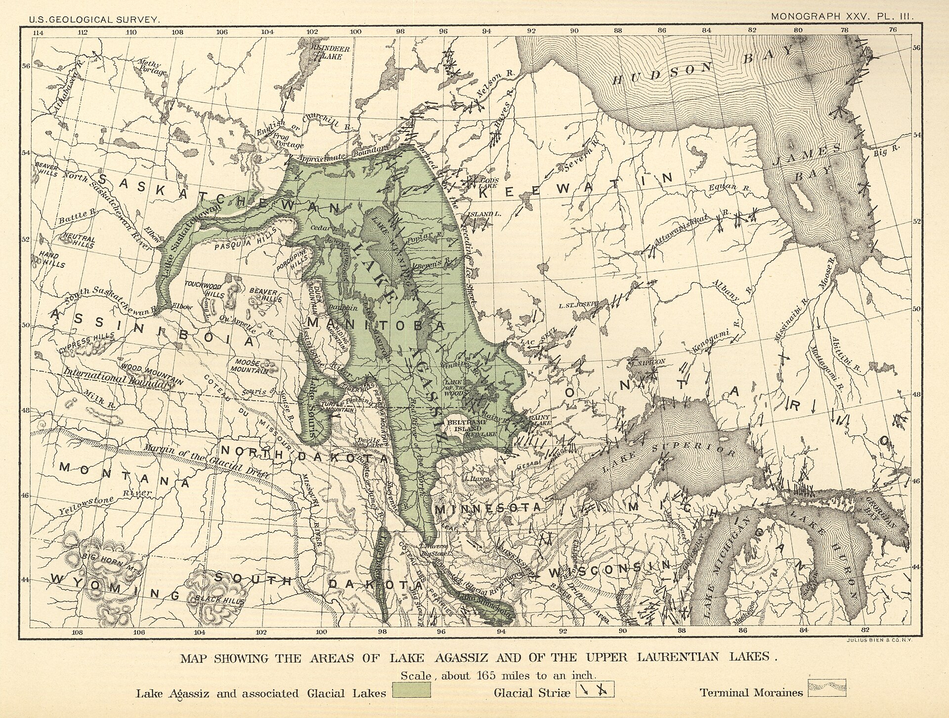
Geologists have mapped Lake Agassiz through its abandoned shorelines, deltas and outlet channels for over a century, beginning with Warren Upham's classic USGS survey. The lake drained catastrophically more than once as ice dams gave way and outlets switched between the Mississippi, the Great Lakes and Saint Lawrence, and the Arctic via the Mackenzie. The best-supported catastrophe is the final drainage around 8,200 years ago: as the Laurentide ice finally parted, Agassiz and neighbouring Lake Ojibway emptied into Hudson Bay in a colossal pulse, estimated at over 150,000 cubic kilometres of fresh water. This flux is widely credited with weakening the Atlantic overturning circulation and causing the '8.2 kiloyear event', a sharp century-scale cooling recorded in Greenland ice.
The lake's outbursts also contributed real, measurable sea-level rise: the 8.2k drainage alone is estimated to have raised global sea level on the order of tens of centimetres, on top of the general post-glacial rise of well over a hundred metres that was steadily submerging coastlines worldwide. Whether an earlier Agassiz outburst triggered the much larger Younger Dryas cold reversal around 12,900 years ago is more contested: the classic model routed meltwater east down the Saint Lawrence, but field workers have struggled to find that flood path, and some now favour a northwest route to the Arctic instead.
- Mapped relict shorelines, deltas and outlet channels tracing the lake's rise and fall (Upham onward)
- The c. 8,200-year-old final drainage of Agassiz-Ojibway into Hudson Bay, over 150,000 cubic kilometres
- Correlation of that outburst with the 8.2k cooling event recorded in Greenland ice cores
- Estimated tens of centimetres of near-instant global sea-level rise from the final drainage
- Switching outlet geochemistry and sediment linking Agassiz meltwater to multiple ocean basins