Ancient Engineering · Hawara, Faiyum, Egypt

Hawara Pyramid & the Lost Labyrinth

Herodotus said it surpassed the pyramids; radar suggests something vast still lies under the sand.

Mainstream: c. 1860-1814 BC (12th Dynasty, Amenemhat III)Alternative: Pyramid date accepted; the buried labyrinth claimed as an intact archive awaiting excavation29.27°, 30.90°

At a glance

Hawara Pyramid & the Lost Labyrinth
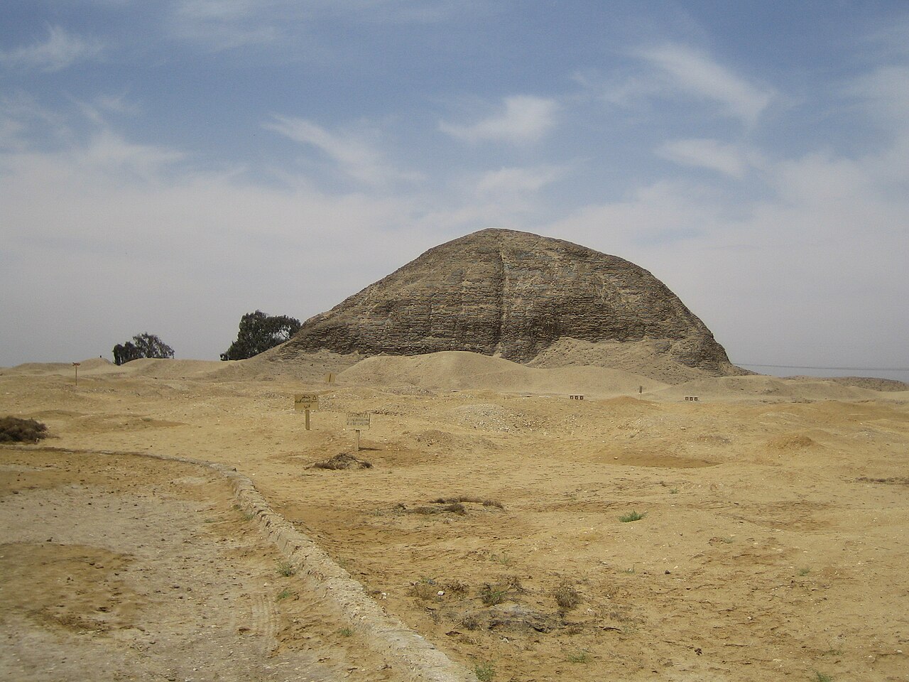
Photo: Axel Seedorff · CC BY-SA 2.0 DE

At Hawara, near the entrance to the Faiyum oasis, the 12th Dynasty pharaoh Amenemhat III raised a mudbrick pyramid whose white limestone casing has long vanished. South of it once stood his enormous mortuary temple — identified by classical authors as the Labyrinth, a building Herodotus visited in the fifth century BC and declared to surpass even the pyramids, with (he was told) three thousand rooms on two levels. Flinders Petrie located its remains in 1888, and in 2008 the Belgian-Egyptian Mataha Expedition ran geophysical scans over the site, reporting grid-like anomalies at depth that reignited a very old question: is anything of the Labyrinth still down there?

See it on the globe →
The mainstream view

What archaeology says

Amenemhat III built two pyramids — an abandoned one at Dahshur and this one at Hawara, where he was buried in a burial chamber hollowed from a single block of quartzite estimated at over 100 tonnes, sealed by an ingenious sand-lowered roof slab. The vast complex to the south, roughly 304 by 244 metres by Petrie's survey of 1888-89, was his mortuary temple. Classical writers — Herodotus, Strabo, Diodorus, Pliny — described it as the Labyrinth, and Strabo, who also visited, spoke of vaulted courts and bewildering passages.

Petrie's sober conclusion was that the Labyrinth had been almost totally destroyed, quarried for stone from Roman times onward, leaving only a huge artificial bed of sand, limestone chips and fragments. Most Egyptologists today accept that verdict: the marvel the Greeks saw was a grand but comprehensible Middle Kingdom temple complex, and what survives is its robbed-out foundation platform, now further threatened by a rising water table fed by the Bahr Wahbi canal that cuts across the site.

The 2008 survey data has been treated cautiously by mainstream researchers: geophysics in waterlogged, rubble-rich ground is notoriously ambiguous, and anomalies are not architecture until a spade confirms them. Egypt's Ministry of Tourism and Antiquities announced renewed fieldwork at Hawara in May 2026, alongside international proposals to dewater the site — steps most scholars welcome regardless of what they expect to find.

Key evidence cited
  • Petrie's 1888-89 excavations found a quarried-out foundation bed, not intact halls
  • Roman-era stone robbing at Hawara is well documented, explaining the Labyrinth's disappearance
  • The 304 x 244 metre platform matches classical descriptions of the complex's footprint
  • Middle Kingdom parallels (Dahshur, Lisht) show mortuary temples of grand but conventional design
  • Geophysical anomalies in saturated rubble are known to mimic walls and chambers
  • New official fieldwork at Hawara announced by Egypt's antiquities ministry in May 2026
The alternative view

What the skeptics propose

The Mataha Expedition of 2008 — a collaboration between Belgium's Ghent University, Egypt's National Research Institute of Astronomy and Geophysics (NRIAG) and the artist Louis De Cordier — put the alternative case on an unusually scientific footing. Their ground-penetrating radar and VLF electromagnetic surveys south of the pyramid detected what the team described as a grid of vertical walls several metres thick, forming closed room-like spaces at depths of roughly 8 to 12 metres, spread over hectares. To De Cordier and his colleagues, this is consistent with the Labyrinth's lower storey surviving beneath Petrie's so-called foundation bed.

The aftermath fuelled the story. The findings appeared in the NRIAG scientific journal in autumn 2008, but De Cordier states that publicising them was discouraged pending Supreme Council of Antiquities approval that never came; the expedition's website material later vanished, and he has spent the years since — through the Labyrinth of Egypt project and a Substack of the same name — campaigning for verification drilling and dewatering. Later commercial remote-sensing work, such as the Merlin Burrows satellite scans, has been claimed to support large buried structures, though it remains unpublished in peer-reviewed form.

For the wider alternative community, from Ancient Origins contributors to researchers who see Herodotus's three thousand rooms as literal reportage, Hawara is the best candidate in Egypt for a genuine lost archive — some link it to the legendary Hall of Records. Even stripped of that framing, their core demand is modest and testable: excavate below the water table before the groundwater destroys whatever is left.

Key evidence cited
  • Mataha Expedition GPR showing grid-like features at 8-12 metres depth south of the pyramid
  • VLF-EM anomalies suggesting rooms and walls extending over hectares
  • Publication of the data in the NRIAG journal (autumn 2008) by credentialled geophysicists
  • Herodotus and Strabo were eyewitnesses; both described an underground level
  • The site has never been excavated below the water table, so the claim remains untested
  • Subsequent removal of the expedition's online documentation, read by some as suppression

Genuinely open questions

  1. Do the 2008 geophysical anomalies represent architecture, natural features, or survey artefacts?
  2. Did the Labyrinth ever have the underground storey Herodotus claimed he was not allowed to enter?
  3. Can the site be dewatered before rising groundwater destroys organic and inscribed material?
  4. How much of Amenemhat III's temple complex survives beneath the Ptolemaic and Roman cemetery layers?

Worth knowing

The same cemetery at Hawara yielded the hauntingly lifelike Fayum mummy portraits — some of the most modern-looking faces to survive from antiquity.