Origins of Civilisation · West Carroll Parish, Louisiana, USA

Poverty Point

3,400 years ago, hunter-gatherers without farms, wheels or beasts of burden moved two million cubic metres of earth — some of it in weeks.

Mainstream: c. 1700–1100 BC (Late Archaic)Alternative: Date not seriously disputed — the argument is over how mobile hunter-gatherers built a monumental city-scale complex, not when32.64°, -91.41°

At a glance

Poverty Point
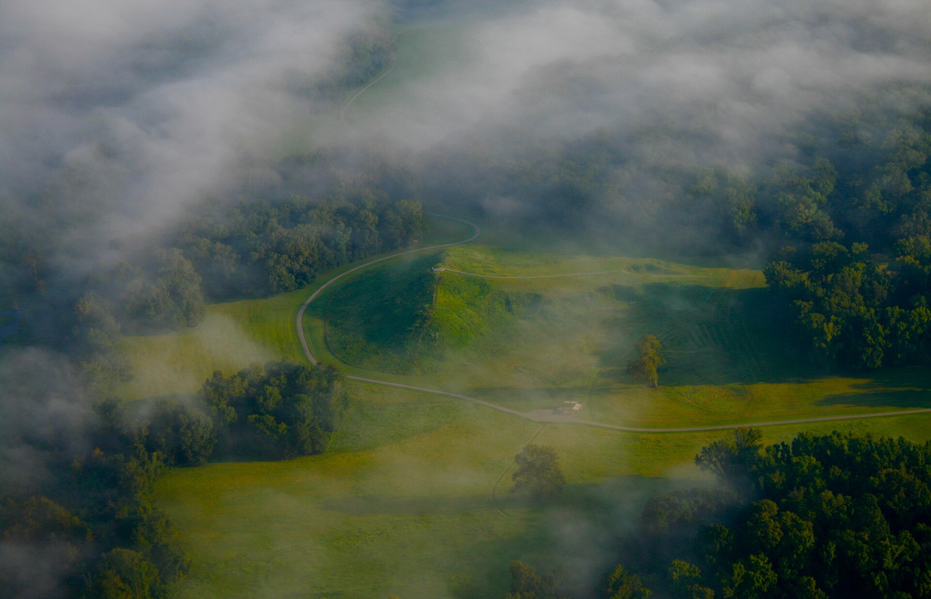
Photo: Jennifer R. Trotter · CC BY-SA 4.0

Poverty Point, named after a 19th-century plantation, is a vast earthwork complex on Macon Ridge overlooking the Mississippi floodplain: six concentric C-shaped ridges spanning over a kilometre, five mounds, and the colossal Mound A — 22 metres tall and often read as a bird in flight — all raised between about 1700 and 1100 BC. Its builders were hunter-fisher-gatherers, yet they created what was then the largest earthwork complex in the Americas and sat at the hub of an exchange network stretching up to 1,600 kilometres, drawing copper from the Great Lakes, galena from Missouri and soapstone from the Appalachians. UNESCO inscribed the site on the World Heritage List in 2014 as a masterpiece of 'forager monumentality'.

See it on the globe →
The mainstream view

What archaeology says

Poverty Point has forced archaeology to abandon the tidy rule that monuments require agriculture. Anthony Ortmann and Tristram Kidder's analysis of Mound A, published in 2013, found no weathering horizons, no rainwash lenses and no vegetation between its construction loads: roughly 238,000 cubic metres of earth — basket by basket — was raised in a single sustained effort, plausibly within 30 to 90 days. That implies thousands of people provisioned on site by fishing, hunting and harvesting nuts, coordinated without any evidence of coercive chiefs. Kidder's Washington University team showed in 2021 that the ridges at Ridge West 3 were likewise built rapidly, and that the builders were expert geotechnical engineers, blending clays, silts and loess into an almost concrete-like fill that has resisted erosion in a rain-soaked landscape for over three millennia.

Interpretation has shifted with the evidence. Rather than a permanent 'city' of resident thousands, a 2025 study led by Kidder in Southeastern Archaeology reframes Poverty Point as a ritual aggregation site: during a period of increased flooding and climatic disruption in the Lower Mississippi Valley between about 4000 and 3000 years ago, dispersed and broadly egalitarian communities converged periodically to perform world-renewing ceremonies — building earthworks, depositing bundles of exotic materials, then dispersing again. The millions of baked-clay 'Poverty Point Objects' used for earth-oven cooking, and the extraordinary volume of imported stone in a stoneless alluvial landscape, fit a place of episodic mass gathering.

The site's geometry — Kenneth Sassaman, John Clark and others have argued the layout deploys standard units of measure and possibly equilateral-triangle geometry — shows planning at a scale previously thought impossible for non-agricultural societies, and has rippled through global debates about sites like Goebekli Tepe.

Key evidence cited
  • Ortmann and Kidder's 2013 stratigraphic evidence that Mound A rose in a single rapid effort, possibly 30–90 days
  • 2021 Washington University analyses showing engineered soil mixes in the ridges that have resisted erosion for 3,400 years
  • Sourcing studies tracing copper, galena, soapstone and other materials up to 1,600 km along river routes
  • Millions of baked-clay cooking objects and abundant fish and nut remains — a forager economy, no crops
  • The 2025 Kidder-led study tying construction episodes to flood-era ritual aggregation by egalitarian groups
The alternative view

What the skeptics propose

Poverty Point's earliest 'alternative' interpretation was the Mound Builder myth: 19th-century writers could not accept that ancestors of Native Americans built such works and invented lost races — Atlanteans, Welsh princes, Lost Tribes — to explain them, a view demolished by Cyrus Thomas in 1894. Modern fringe writers continue the tradition in softer form. Frank Joseph and contributors to Atlantis Rising magazine have cast Poverty Point as a colony or trading outpost of a seafaring civilisation, pointing to its sudden appearance, its command of long-distance exchange, and the bird-mound form they link to diffusionist symbols elsewhere. Others fold the site into ley-line and sacred-geometry systems, or claim its layout encodes astronomical knowledge too advanced for its time; von Daeniken-style ancient-astronaut treatments occasionally cite the scale of earth-moving as beyond Archaic capability.

Archaeologists answer each point directly. The site did not appear from nowhere: Louisiana's Watson Brake mounds are nearly 2,000 years older, showing a long local tradition of hunter-gatherer mound-building. The exchange network is documented by sourcing studies of real artefacts moving along rivers, requiring canoes rather than ocean fleets. Claimed solstice alignments through the ridged plaza have been tested — J. W. Brandau and Kenneth Brecher's early archaeoastronomical proposals were examined by Robert Purrington, who found the alignments unconvincing once topography and dating were considered, though debate about some sightlines continues.

Steelmanned, the fringe fastens onto something real that mainstream science itself spent a century underestimating: hunter-gatherers were 'not supposed' to do this. The honest resolution is that the assumption, not the site, was wrong — Poverty Point is now the textbook case proving that foragers could plan, engineer and mobilise labour at monumental scale, which is precisely why UNESCO listed it.

Key evidence cited
  • The sheer anomaly of hunter-gatherers building North America's largest earthworks of the era, long deemed impossible
  • Frank Joseph's diffusionist reading of the site as an outpost of a lost seafaring civilisation
  • Claimed solstice and equinox sightlines through the plaza and ridge corridors (Brandau; contested by Purrington)
  • The bird-effigy form of Mound A, linked by fringe writers to diffusionist bird symbolism worldwide
  • 19th-century lost-race traditions that denied Indigenous authorship of the mounds

Genuinely open questions

  1. How many people gathered at Poverty Point, and how were thousands of short-term builders fed and organised without farming or visible hierarchy?
  2. Is Mound A really a bird effigy, and what did the concentric ridge design mean to its makers?
  3. Why did construction and the great exchange network cease around 1100 BC — climate, flooding, or social change?

Worth knowing

Lacking local stone for cooking, Poverty Point's people hand-moulded millions of baked clay balls to heat their earth ovens — archaeologists use the distinctive 'Poverty Point Objects' as a signature of the culture across the Gulf South.