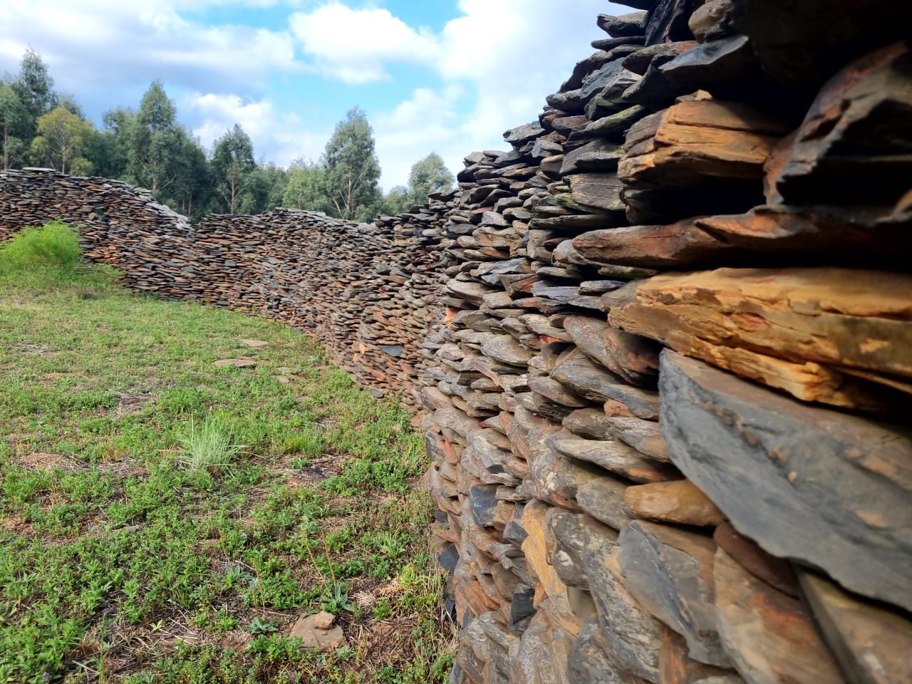
Origins of Civilisation · near Kaapsehoop, Mpumalanga, South Africa

Adam's Calendar & the Mpumalanga Stone Circles

Thousands of stone circles cover the escarpment — a lost Anunnaki metropolis, or one of Africa's great forgotten farming civilisations?

Mainstream: c. AD 1500–1820 (Bokoni agricultural settlements)Alternative: 75,000 to 200,000+ years ago (Tellinger and Heine's claims — rejected outright by archaeology)-25.59°, 30.29°

At a glance

Adam's Calendar & the Mpumalanga Stone Circles
Photo: Sháron Viljoen · CC BY-SA 4.0

Across some 10,000 square kilometres of the Mpumalanga escarpment, from Ohrigstad down to Carolina, the grasslands are laced with tens of thousands of dry-stone structures: circular homesteads, cattle kraals, agricultural terraces and long walled roads linking them into a connected landscape. One hilltop arrangement of standing dolerite stones near Kaapsehoop — officially the Blaauboschkraal stone ruins — has become world-famous under the name 'Adam's Calendar', promoted as the oldest man-made structure on Earth. The gulf between the two stories could hardly be wider: mainstream archaeology sees the remains of Bokoni, a prosperous African farming society of the last five centuries; alternative author Michael Tellinger sees a 200,000-year-old civilisation founded by gold-mining visitors from the stars.

See it on the globe →
The mainstream view

What archaeology says

Archaeologists and historians — notably Peter Delius, Tim Maggs and Alex Schoeman, whose research is synthesised in the book Forgotten World — identify the stone-walled sites as the settlements of the Bokoni ('people of the Koni'), Sotho-Tswana-speaking farmers who flourished here from around the 16th century until the regional upheavals of the early 19th. The evidence is abundant and ordinary in the best sense: excavated homesteads yield pottery, iron tools, grindstones, cattle byres and datable hearths; optically stimulated luminescence dates on terrace sediments confirm construction within the last few centuries; and oral histories and early colonial records describe Koni communities living in and building such settlements.

Far from primitive, Bokoni represents the only known 'island' of intensive terraced agriculture in South Africa. The stone-lined roads — walled so that cattle could be driven between homesteads without trampling crops — and kilometre upon kilometre of hillside terracing reveal sophisticated landscape engineering supporting a population estimated in the tens of thousands. Google Earth surveys and LiDAR-based machine-learning studies continue to map the enormous extent of the system.

The 'calendar' itself sits within this Bokoni landscape. Researchers regard the Blaauboschkraal monoliths as part of a Bokoni ceremonial or homestead complex — and note that some of the dramatic upright dolerite blocks may simply be natural outcrop incorporated into the walling. The site is a declared provincial heritage site under South African law, protected as part of the Bokoni cultural landscape.

Key evidence cited
  • Optically stimulated luminescence dates on Bokoni terraces and homesteads within the last few centuries
  • Excavated pottery, iron tools, grindstones and cattle byres typical of Sotho-Tswana farming culture
  • Oral histories and early written records identifying the Koni people as the builders
  • The integrated landscape of terraces, walled roads and homesteads showing a coherent agricultural system
  • Absence of any artefacts, burials or occupation debris remotely approaching 75,000 years old
The alternative view

What the skeptics propose

The alternative story begins in 2003, when pilot Johan Heine, flying over the escarpment, was struck by the hilltop stone arrangement and began measuring alignments. He and author Michael Tellinger named it Adam's Calendar, arguing the monoliths form a functioning solar calendar whose alignments to the equinoxes, solstices and the rise of Orion's belt could be back-calculated — using the precession of the equinoxes — to an original construction date of at least 75,000 years ago, later inflated in Tellinger's books and lectures to 200,000–300,000 years. Building on Zecharia Sitchin's Anunnaki mythology, Tellinger claims the millions of stone circles were not homesteads at all but components of a vast energy-generating machine — he reports measuring electromagnetic and acoustic anomalies at the walls — built by early humans engineered as labourers for extraterrestrial gold miners. He points to the region's many old mining excavations as evidence of this ancient industry, and runs a museum and tours at the site promoting the theory.

Archaeologists reject every element of this. Neither Tellinger nor Heine has training in archaeology or archaeoastronomy, and independent checks find the claimed Orion alignment simply does not work in any epoch. The erosion-based and precessional dating methods are considered meaningless for stacked fieldstone, which cannot be dated by weathering; meanwhile actual dating methods — luminescence, radiocarbon, artefact typology — consistently return the last five centuries. The 'ancient gold mines' are historic-era and 19th–20th century workings. Critics, including South African heritage bodies and researchers like Delius and Schoeman, add a sharper point: claiming the ruins are too old to be African-built repeats, in New Age dress, the same colonial logic once used at Great Zimbabwe — writing real African achievement out of history in favour of imaginary outsiders.

Key evidence cited
  • Heine and Tellinger's claimed solar and stellar alignments of the Blaauboschkraal monoliths
  • Tellinger's precession-based back-calculation yielding dates of 75,000+ years
  • Reported electromagnetic and acoustic anomalies Tellinger measures at the stone circles
  • The sheer number of structures — which Tellinger argues is too vast for the recorded population
  • Old mining excavations across the region, read by Tellinger as evidence of ancient gold extraction

Genuinely open questions

  1. How was labour organised to build tens of thousands of structures and terraces across 10,000 square kilometres?
  2. What role did the Blaauboschkraal monoliths play within Bokoni society — ceremonial, practical or both?
  3. How far did Bokoni trade networks reach, and why does intensive terracing appear only in this one region of South Africa?

Worth knowing

The walled Bokoni roads were essentially cattle highways — built so herds could be moved between homesteads without trampling the terraced crops, forming one of precolonial Africa's most extensive engineered road networks.